
OKLAHOMA AND INDIAN TERRITORY ALONG THE FRISCO SYSTEM
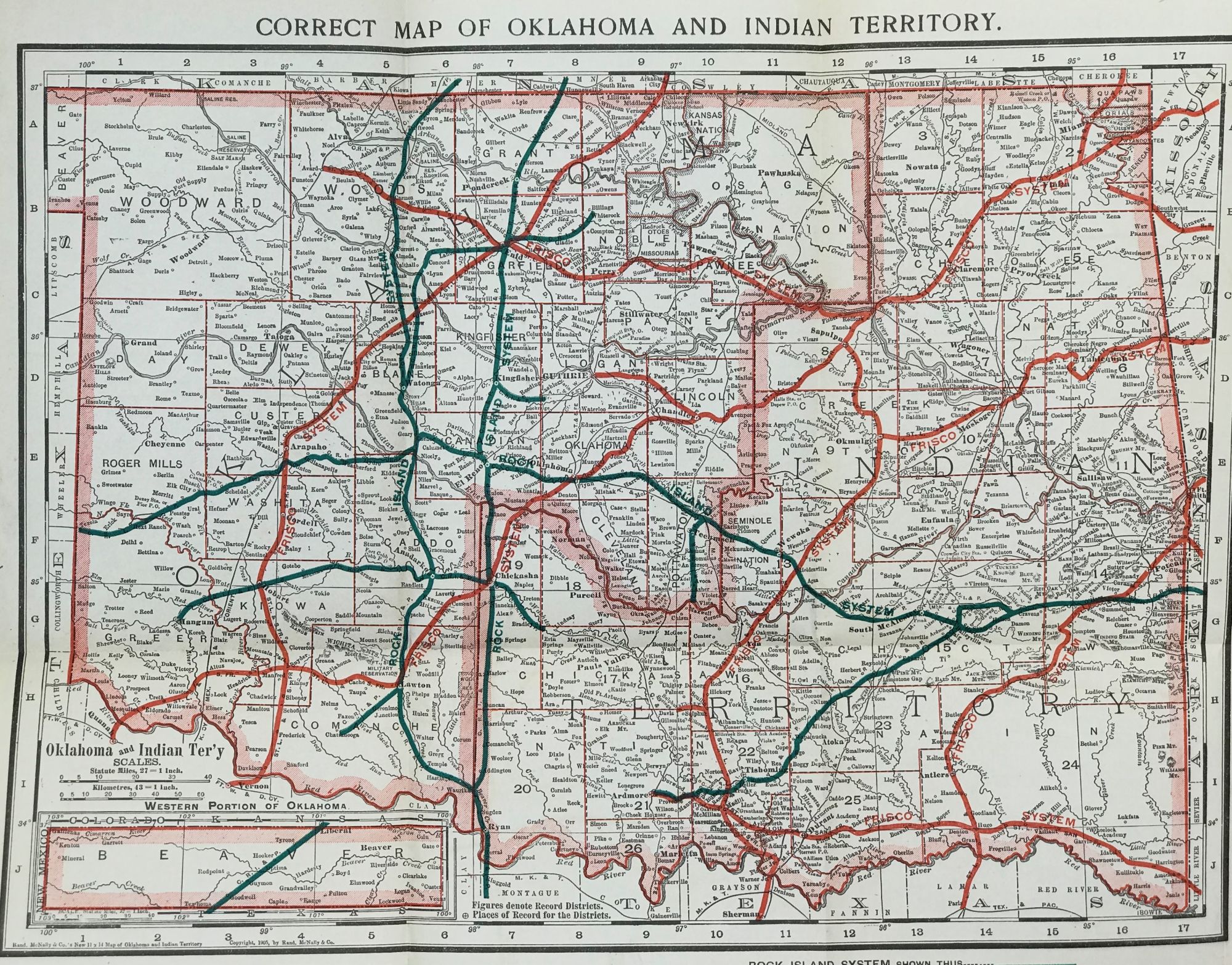
St. Louis, [MO]: Woodward and Tiernan Printing Co., 1905. Printed grey-green paperwraps, some chipping to spine and front wrapper, short splits at spine. 7 3/8 x 5 1/8in. 91pp., photo illustrations. Two folding maps tipped in, one at the front, one at the back: Frisco System (showing the railroad lines running from Chicago and St. Louis and on into Oklahoma and Indian Territory; short splits aling a couple of folds); Correct Map of Oklahoma and Indian Territory (showing the Frisco lines in red and the Rock Island lines in blue). OCLC lists two copies: Yale; Univ. of Texas at Arlington. Item #67083
Price: $650.00
See all items in
Americana