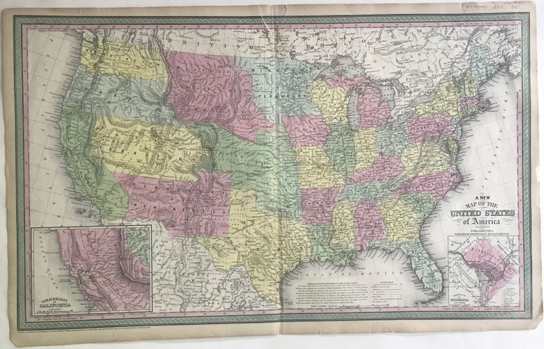
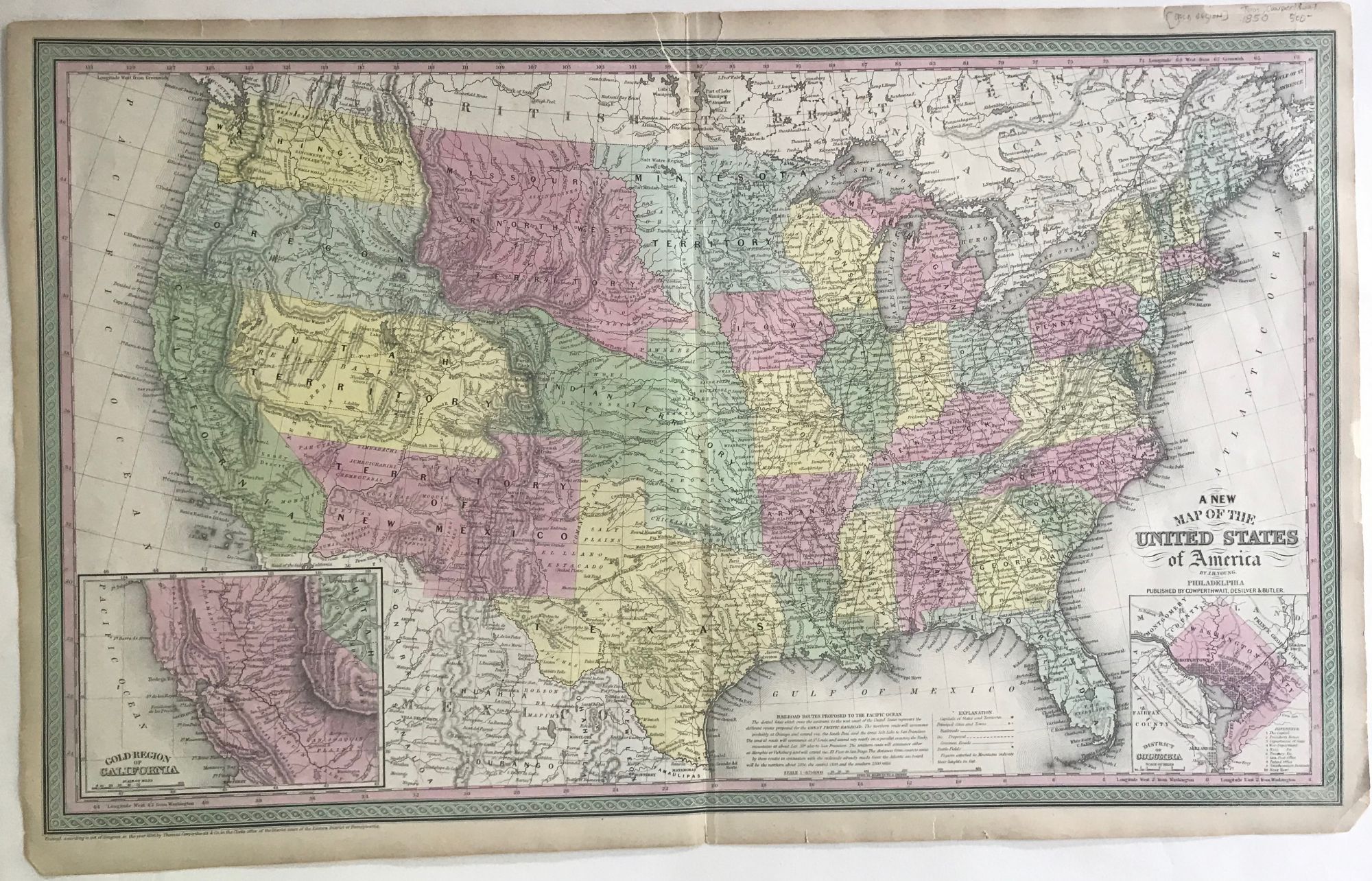
A NEW MAP OF THE UNITED STATES OF AMERICA
Philadelphia, [PA]: Published by Cowperthwait, Desilver & Butler, 1850. Map, 43.5 x 69 cm. Image size 40.5 x 67cm., enclosed in a double border of pink and green. States and territories hand colored. Two insets, one of the District of Columbia, and one of the Gold Region of California. Map also shows the various proposed railroad routes to the Pacific Ocean, and places Native American tribes within territories and western states. Small thumbnail size tear at center top edge, repaired on verso. Item #66135
Price: $500.00
See all items in
Americana,
Western Americana
See all items by J. H. YOUNG