
THE NAVIGATOR: OR THE TRADERS' USEFUL GUIDE IN NAVIGATING THE MONONGAHELA, ALLEGHENY, OHIO, AND MISSISSIPPI RIVERS... ILLUSTRATED WITH THIRTEEN ACCURATE MAPS OF THE MISSISSIPPI, AND ONE OF PITTSBURGH. The Fifth Edition, much improved and enlarged. To Which is Added, An Account of Louisiana....
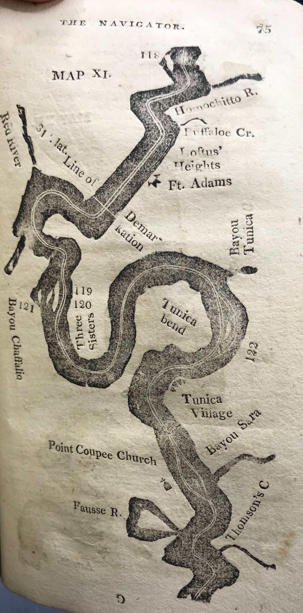
Pittsburgh [PA]: From the Press of Zadok Cramer, 1806. Period marbled paperwraps, spine partly perished, some loss and chipping to wrappers, front wrapper nearly detached. 17 cm. [2 preliminary leaves], [3] - 94pp., including 14 charts (ie: a map of Pittsburgh and 13 river charts). An unsophisticated copy. From the introduction by the editor on the verso of the title page: "This edition of the Navigator, being the fifth since the year 1801, is respectfully presented to the public. It being designedly calculated as an useful and necessary guide to those who navigate or trade on the rivers of which it treats, much pains have been taken to revise, correct, and enlarge it throughout...." The editor goes on to thank his sources for information, including Mr. Chambers of Cincinnati for "useful hints respecting the Ohio from that place to the Kentucky river... [and] Mr. Charles Wilkins, of Kentucky [for] a chart of the Mississippi, taken by himself last year, from the mouth of Ohio to Natchez; from that place to New-Orleans we were presented with one taken from actual survey; and from these we were guided in making those maps which are now for the first time added to this publication...."
According to Buck's "Travel and Description, 1765-1865," [NY: 1971], pp.43-44: "Cramer was probably the first man to compile this sort of a guide to the western waters and his work was the foundation for Cumings 'Western Navigator and Western Pilot,' and Gilleland 'Ohio and Mississippi Pilot.' It was much used by travelers, not only as a guide, but as a source of information for their books, and frequently without credit."
This copy is the fifth edition of the "most widely used guide to western water in the early period, both before and after the application of steam in 1807." (Howes). Streeter notes this is the first edition to include navigating charts. The fifth edition also includes an account of Louisiana, newly purchased by the United States in 1803. The first known printing, the third edition, was published in 1802; the fourth edition is the first one to include the Mississippi. OCLC lists 11 copies of the fifth edition. The Streeter copy sold for $1700 in 1967.
HOWES C855 AMERICAN IMPRINTS 10224 STREETER 2:991 SABIN 17384. Item #64434
Price: $9,500.00