Seat of War, Manassas and Its Vicinity.
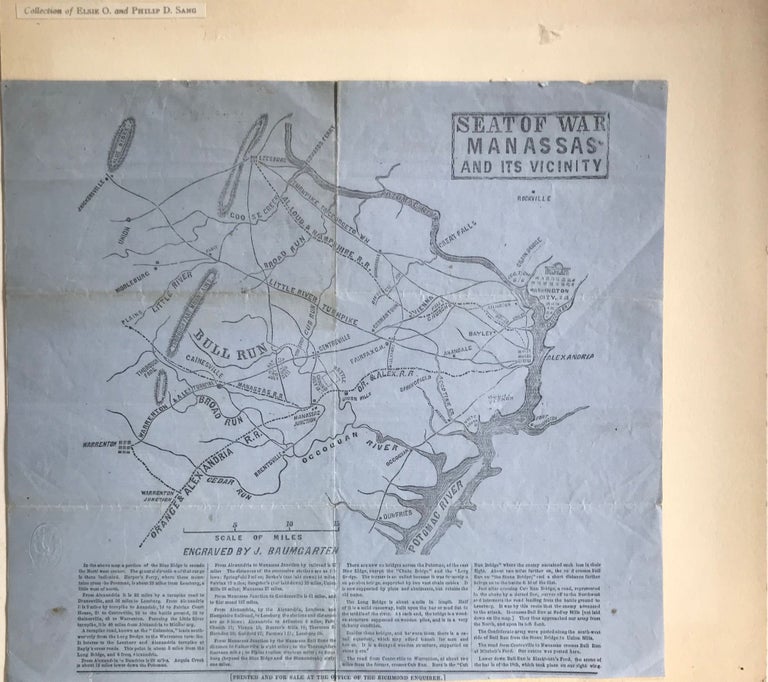
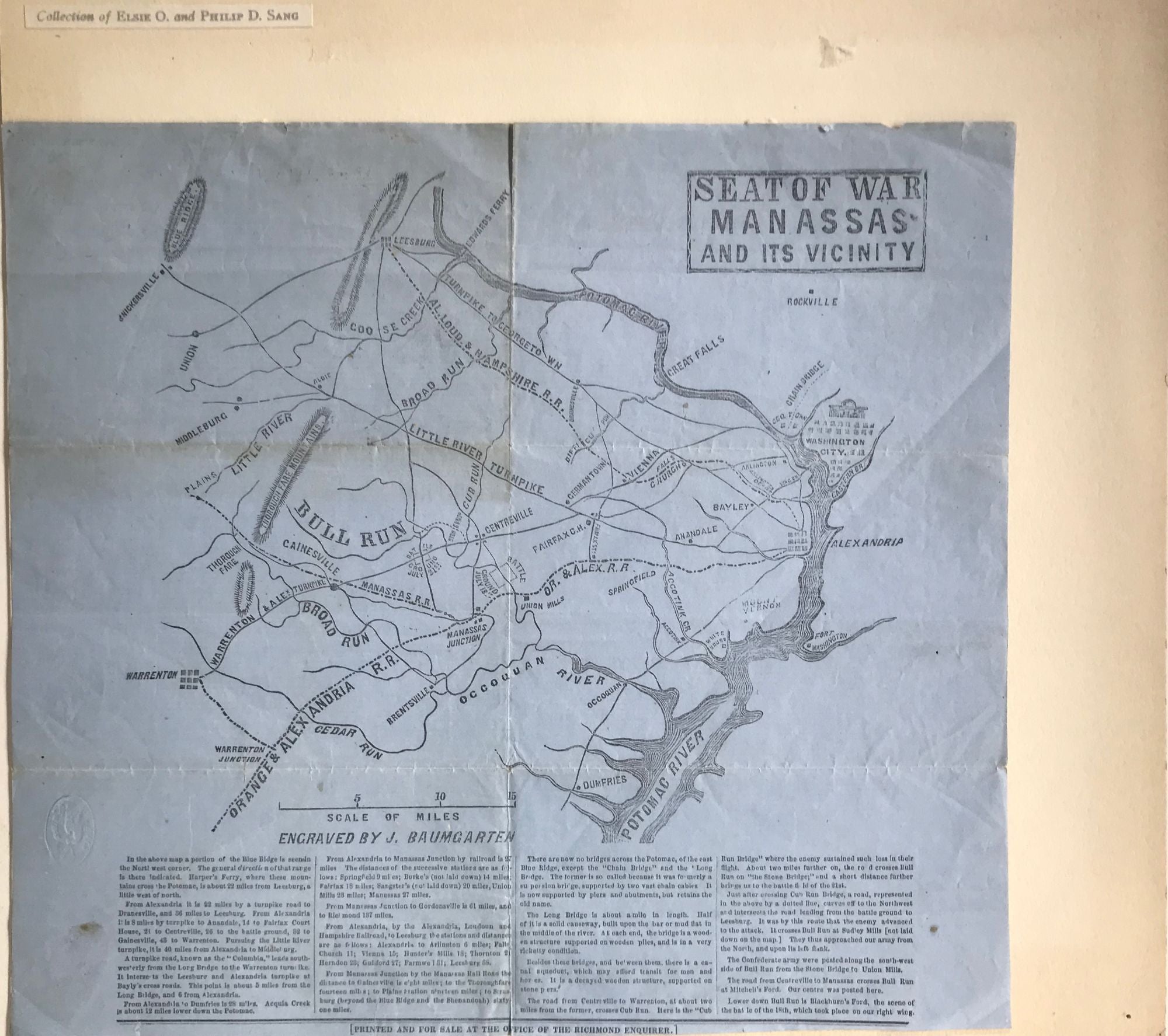
Richmond, VA: Printed and for sale at the Office of the Richmond Enquirer, [1861]. First separate edition (also appeared in an issue of the newspaper). Printed broadside map, 11 1/4 x 12 1/4 inches, on blue paper, showing the environs of Manassas Junction to Washington, D.C., to the east, and to Snickersville and Warrenton, to the west, with the Potomac River prominently featured, along with the sites of battles at Blackburn's Ford on July 18, 1861, and the major battle at Bull Run on July 21; below the map is printed four columns of text describing the topographical features represented by the map and a brief account of the military actions. Parrish & Willingham 6200 (Huntington, Library of Congress, Emory, Georgia, Illinois, Boston Athenaeum, Duke, North Carolina, South Carolina Historical Society, Museum of the Confederacy, Virginia State Library, Virginia Historical Society). Scarce in trade; since this copy sold in 1981, only one other has appeared at auction (RareBookHub: Cowan's, 2008, $1610, with a tear). Old fold lines, archivally attached to a large sheet of paper, with the ownership label of Elsie O. and Philip D. Sang mounted along the upper left corner; this copy sold at the Sang sale, part five, 27 November 1981. Very good. (10182). Item #63410
Price: $3,000.00