![Item #62157 LATEST MAP OF SOUTH DAKOTA. [cover title]. Hillyer Bros., Joens Real Estate.](https://bartlebysbooks.cdn.bibliopolis.com/pictures/62157.jpg?width=768&height=1000&fit=bounds&auto=webp&v=1553708155)
![LATEST MAP OF SOUTH DAKOTA. [cover title]](https://bartlebysbooks.cdn.bibliopolis.com/pictures/62157_2.jpg?auto=webp&v=1553708155)
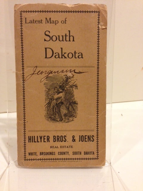
LATEST MAP OF SOUTH DAKOTA. [cover title]
Sioux Falls, S.D. Brown & Saenger, Printers, nd (ca.1915). Folding map, 32 x 47 cm., on a 44 x 55 cm. sheet, tipped into tan paperwraps with a small illustration of a farmer on the front wrap, a township and range grid printed on the rear wrap. Previous owner's signature on front wrap. Map and counties outlined in red, with a few counties in the eastern portion of the state colored in yellow. Indian reservations shown. Title on the map: "South Dakota" by E. Frank Peterson, Lake Andes, S.D., publisher of the "Illustrated Historical Atlas of South Dakota." Printed for Hillyer Bros. & Joens Real Estate, White, Brookings County, South Dakota, who advertise in the borders of the map offering "fine improved farms from $50 to $95 per acre." Date implied from the inset chart of "average yields of the twenty principal corn growing states of this country for 1915." Peterson's map was used by several real estate companies to promote settlement in the state. No OCLC listings found for this particular real estate company, though there are several similar. A nice, crisp copy, with a bit of wear to the outer wrappers. Item #62157
Price: $375.00