![Item #62017 SOUTHERN RURALIST: THE SOUTH'S FOREMOST FARM PAPER. [caption title]](https://bartlebysbooks.cdn.bibliopolis.com/pictures/62017.jpg?width=768&height=1000&fit=bounds&auto=webp&v=1595704697)
![SOUTHERN RURALIST: THE SOUTH'S FOREMOST FARM PAPER. [caption title]](https://bartlebysbooks.cdn.bibliopolis.com/pictures/62017_2.jpg?auto=webp&v=1595704697)
![SOUTHERN RURALIST: THE SOUTH'S FOREMOST FARM PAPER. [caption title]](https://bartlebysbooks.cdn.bibliopolis.com/pictures/62017_3.jpg?auto=webp&v=1595704697)
![SOUTHERN RURALIST: THE SOUTH'S FOREMOST FARM PAPER. [caption title]](https://bartlebysbooks.cdn.bibliopolis.com/pictures/62017_4.jpg?auto=webp&v=1595704697)
![SOUTHERN RURALIST: THE SOUTH'S FOREMOST FARM PAPER. [caption title]](https://bartlebysbooks.cdn.bibliopolis.com/pictures/62017_5.jpg?auto=webp&v=1595704697)
![SOUTHERN RURALIST: THE SOUTH'S FOREMOST FARM PAPER. [caption title]](https://bartlebysbooks.cdn.bibliopolis.com/pictures/62017_6.jpg?auto=webp&v=1595704697)
![SOUTHERN RURALIST: THE SOUTH'S FOREMOST FARM PAPER. [caption title]](https://bartlebysbooks.cdn.bibliopolis.com/pictures/62017_7.jpg?auto=webp&v=1595704697)
![SOUTHERN RURALIST: THE SOUTH'S FOREMOST FARM PAPER. [caption title]](https://bartlebysbooks.cdn.bibliopolis.com/pictures/62017_8.jpg?auto=webp&v=1595704697)
![SOUTHERN RURALIST: THE SOUTH'S FOREMOST FARM PAPER. [caption title]](https://bartlebysbooks.cdn.bibliopolis.com/pictures/62017_9.jpg?auto=webp&v=1595704697)
![SOUTHERN RURALIST: THE SOUTH'S FOREMOST FARM PAPER. [caption title]](https://bartlebysbooks.cdn.bibliopolis.com/pictures/62017_10.jpg?auto=webp&v=1595704697)
![SOUTHERN RURALIST: THE SOUTH'S FOREMOST FARM PAPER. [caption title]](https://bartlebysbooks.cdn.bibliopolis.com/pictures/62017_11.jpg?auto=webp&v=1595704697)
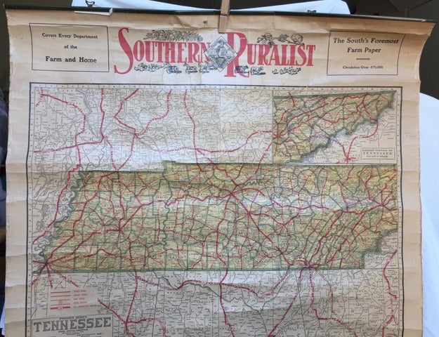
SOUTHERN RURALIST: THE SOUTH'S FOREMOST FARM PAPER. [caption title]
Chicago, IL: Edited, engraved and published by the Geographical Publishing Co., nd [ca.1920s?]. Wall maps of Tennessee, "Dixie," the United States and Europe, and the World. Two sheets (4pp.), each 32 1/2 x 23 in., with maps printed on both sides, joined along top edge with a thin band of metal and a string for hanging. One sheet has the "premier series" map of Tennessee, with an inset map of the eastern portion of the state, in the upper half of the page, accompanied by a group of black & white photo images of scenes from the southern states, including tarpon fishing in Florida, Antoine's Restaurant in New Orleans, Chattanooga Golf & Country Club, Wesleyan College in Macon, GA (the "oldest chartered women's college in the world"), the business district of Birmingham, AL, etc. across the lower half of the page; verso is a map of the World showing the largest cities and population figures. The second sheet has the "Map of Dixie;" verso is a map of Europe in the top half of the sheet and an "intermediate series" map of the U.S. on the lower half. Both the Tennessee and the Dixie map show roads and highways marked in red, providing highway touring data. Lower sections of both sheets have tears extending up two or three inches from the bottom edges of the rolled up maps; small 2 1/2 x 1/2 in. hole in one sheet, affecting the northern Virginia, Washington DC area on the Dixie map. Overall toning, a somewhat tender copy. Item #62017
The Southern Ruralist, founded in Interlachen, Florida in 1896, moved operations to Atlanta in 1899 where it was published until 1930. OCLC lists two copies of the "Map of Dixie," one at Filson Hist. Soc., and one at Univ. of South Carolina, but no mention of the Tennessee map.
Price: $100.00