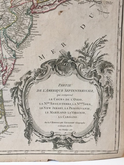
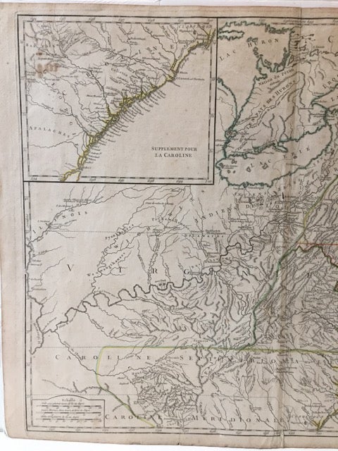
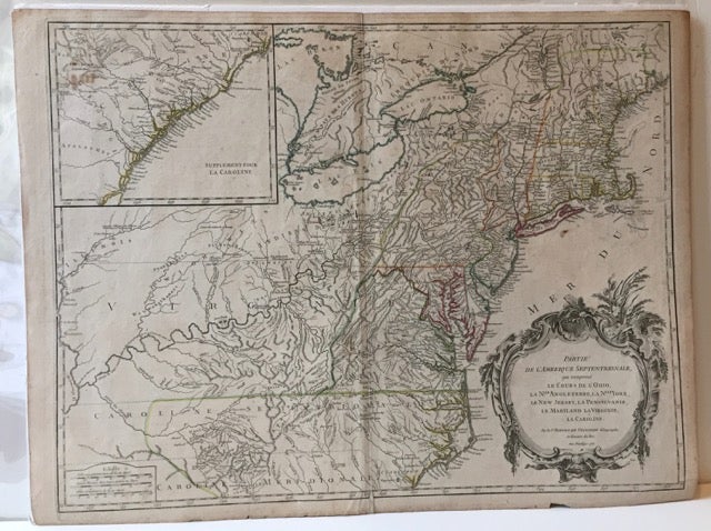
PARTIE DE L'AMERIQUE SEPTENTRIONALE, QUI COMPREND LE COURS DE L'OHIO, LA NLLE. ANGLETERRE, LA NLLE. YORK, LE NEW JERSEY, LA PENSYLVANIE, LE MARYLAND, LA VIRGINIE, LA CAROLINE.
NP [Paris]: np [Robert de Vaugondy], 1755. Map, 18 3/4 x 24 1/2 in., on a 20 x 26 1/2 in. sheet, hand-colored outlines, uncolored cartouche. Inset map of "La Caroline" (coastline) in the upper left corner. Small chip and some short separations along lower margin (one repaired on verso along the centerfold); old paper reinforcement (?) on verso at upper corner, with an old stamped number (104) just below it. An otherwise nice, bright copy. The North American settlements from New England and the Great Lakes to Cape Fear, from the coast to the Mississippi River are delineated, showing Native American villages, Welsh settlements, forts, towns, cities, rivers and mountains, etc. Item #61706
According to Cumming, "The Southeast in Early Maps," 295, [Chapel Hill: 1998], de Vaugondy based the information on this map on John Mitchell's map of North America, issued earlier in 1755. The names on the map, issued in the midst of the French & Indian Wars are a mixture of French and English.
Price: $1,250.00