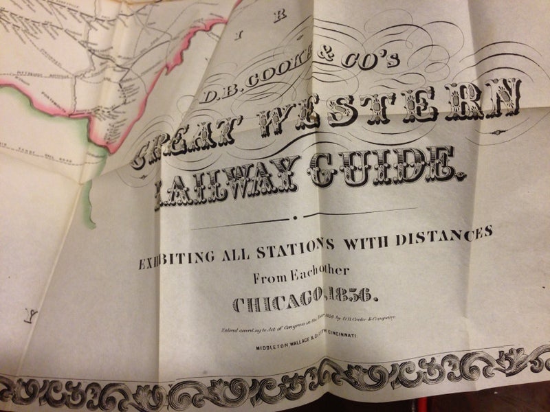
D.B. COOKE & CO's GREAT WESTERN RAILWAY GUIDE. EXHIBITING ALL STATIONS WITH DISTANCES FROM EACH OTHER CHICAGO, 1856.
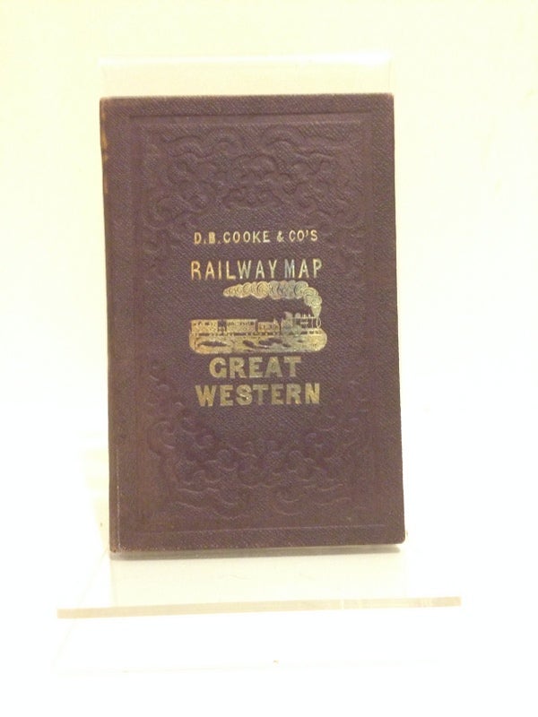
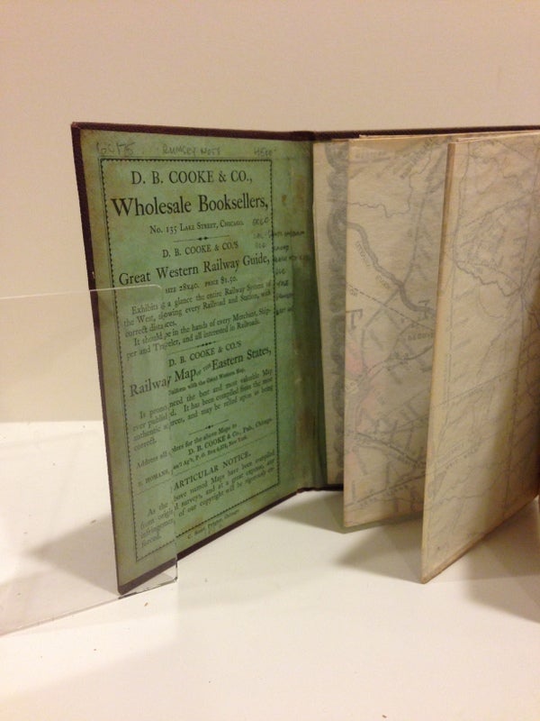
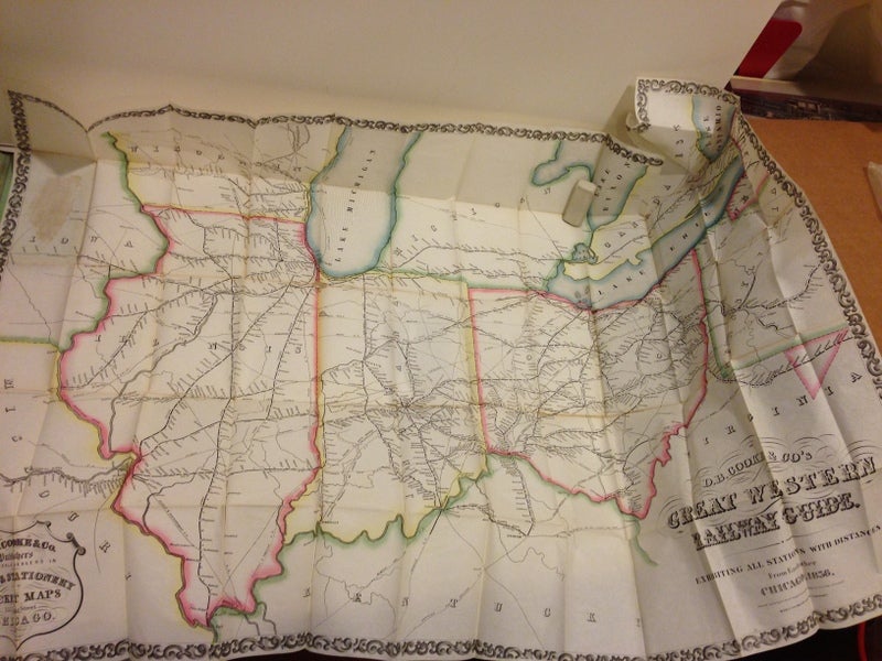
Chicago: D.B. Cooke & Co., Publishers, C. Scott, Printer; Middletin, Wallace & Co., Lith., Cincinnati, 1856. Pocket map, 26 1/2 x 37 1/2 in., folded and tipped in to a gilt and blind stamped brown cloth folder (6 x 3 3/4 in.). Cover title: "D.B. Cooke & Co's Railway Map Great Western," with an illustration of a train stamped in gilt.The states of Ohio, Indiana, and Illinois, are hand colored, outlined in pastels. Parts of the adjacent states and Great Lakes are also shown. Green paper front pastedown carries an ad for the guide, and for another D.B. Cooke & Co. map publication. This Great Western Railway Guide "[e]xhibits at a glance the entire Railway System of the West, showing every Railroad and Station, with correct distances. It should be in the hands of every Merchant, Shipper and Traveler, and all interested in Railroads." Some short separations at folds, else a crisp copy. Item #60175
Rumsey Map Collection: "1st edition was 1855 (Modelski). Elegant and clear railroad map showing Ohio, Indiana, Illinois and parts of the adjacent states. The railroads, both completed and projected, are growing rapidly and reshaping the landscape - the map emphasizes this."
OCLC lists 7 copies: UC-Santa Barbara, Lib. of Congress, Univ. of Chicago, Clarke Hist. Lib., Yale, Princeton, and the British Library.
Price: $4,500.00