CRAM'S VEST POCKET MAP OF WASHINGTON.
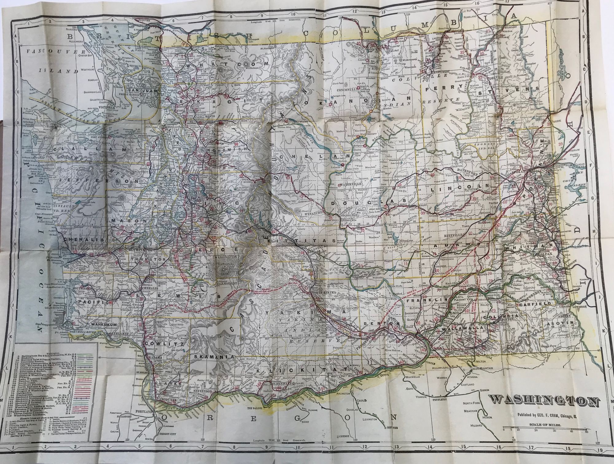
Chicago: George F. Cram, nd (ca. 1910's?). Folding map, 47 x 62 cm., tipped into black lettered brown paper wrapper which has been folded in thirds. "This map shows all counties, cities, towns and villages, principal rivers and lakes. Every name clear and distinct. Just the thing for travelers & others who wish reliable maps." Some short splits along a folds, a few of which have been repaired with archival tape on verso; shallow chips and one closed tear to wraps. A map of Washington state showing the railroads, electric railway lines and traction companies in separate colors (including the "Whatcom County Railway & Light Company," incorporated in 1902, marking the start of Puget Power’s domination of public transportation and power systems in the City of Bellingham, and the "Walla Walla Valley Traction Company," incorporated in 1905, and franchised by Walla Walla to operate trolleys in city limits). Very good. Item #59726
No listings found on OCLC.
Price: $150.00