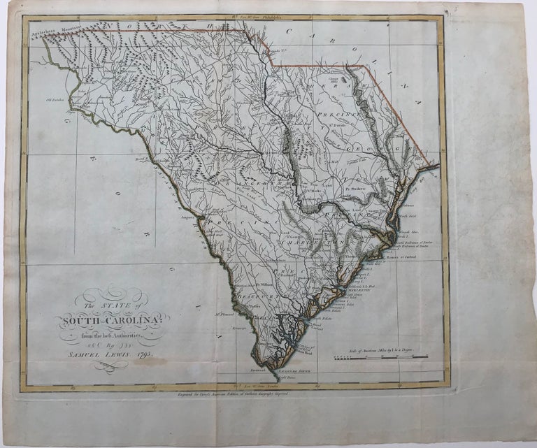
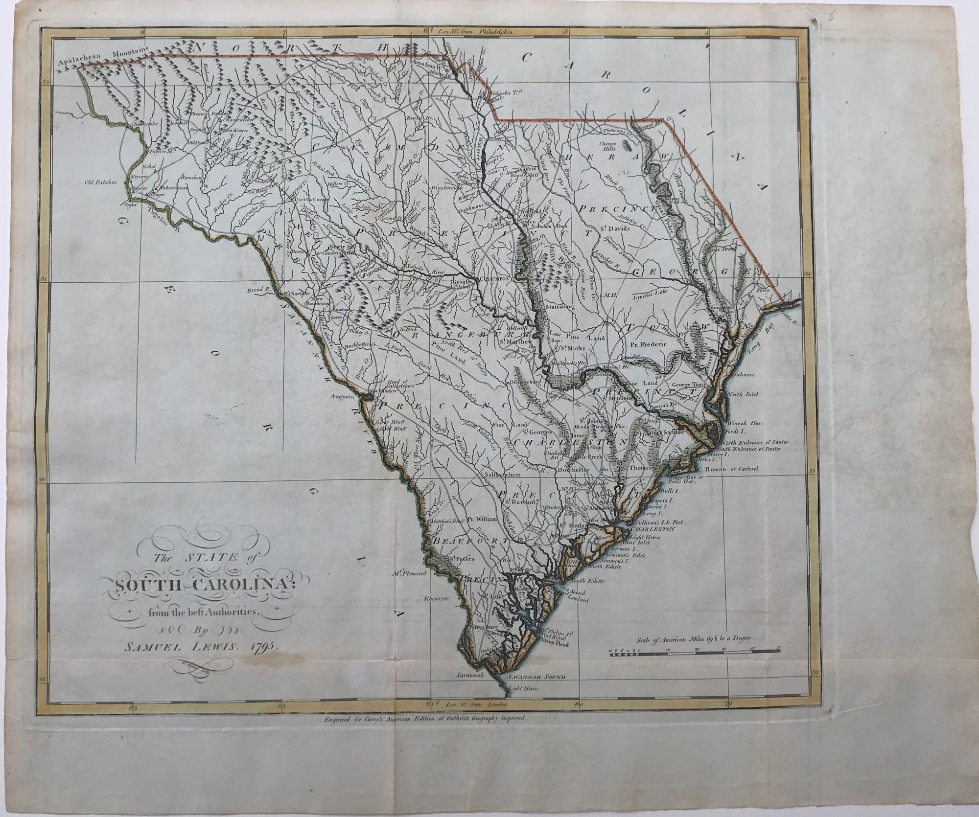
THE STATE OF SOUTH CAROLINA FROM THE BEST AUTHORITIES, 1795.; W. Barker, sculp. Engraved for Carey's American edition of Guthrie's Geography Improved.
[From Mathew Carey's General Atlas, Philadelphia, 1796]. Engraved map, 15 1/4 x 17 3/4 (plate mark measurement), with hand-colored outline, light green wash to swamp areas along rivers. Folded, otherwise a fine copy. Item #44275
Slightly different version of the first map of the state of South Carolina issued the previous year, also by Carey. Includes roads, waterways, mountains, churches, cities, towns, and backwoods settlements. Phillips List of Maps, p. 821. Cf. Karpinski Early Maps of Carolina 86.
Price: $2,000.00
See all items in
Americana
See all items by Samuel Lewis